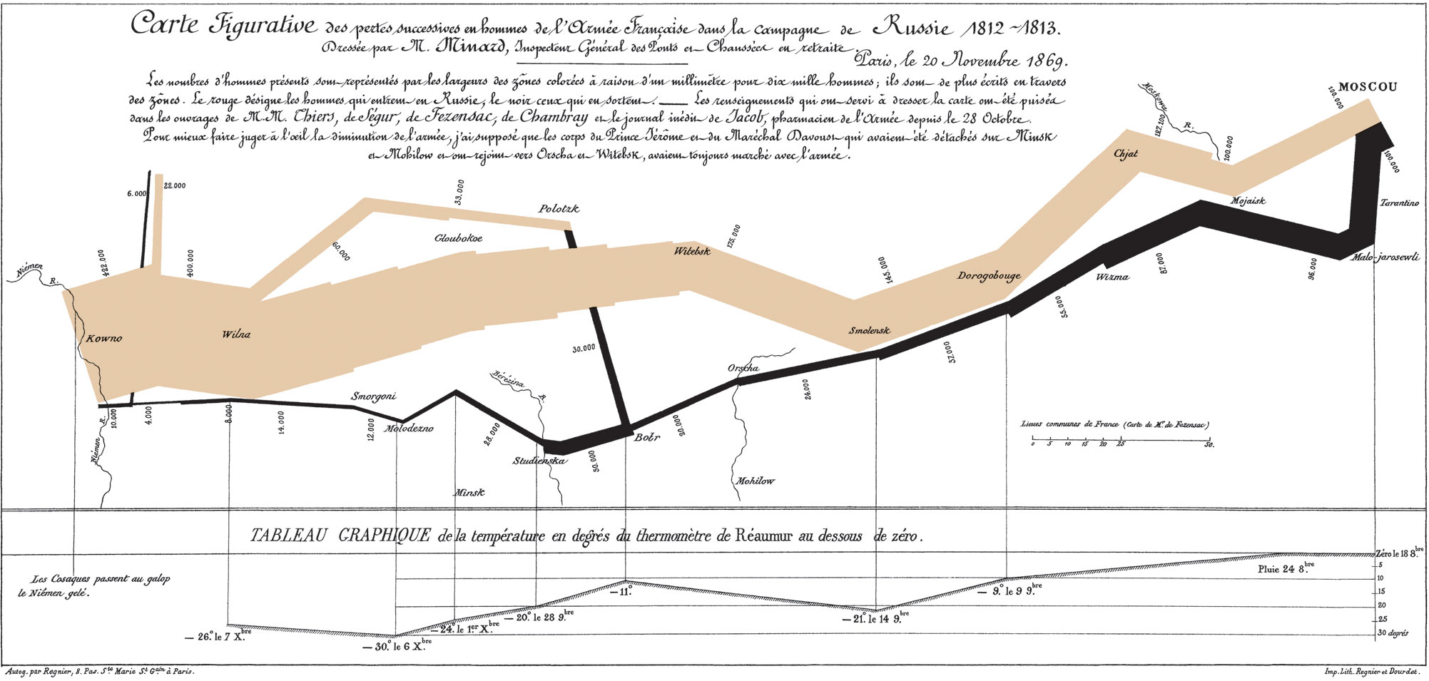
This map, probably one of the most famous in existence, was created in 1869 by Charles Minard, a French civil engineer who also created a wide variety of maps. This one shows the disastrous result of Napoleon’s 1812-1813 Russian campaign. What I really like about this map is the wide variety of information it conveys. The colors show the direction of the army (brown invading, black retreating) overlaid on a map of Russia. In addition, the width of the line shows the size of the army, and as losses increased over time the line thinned. Numbers along the side of the line show the exact number of troops at certain points. Finally, the bottom of the map contains a temperature readout which shows the temperature at a variety of locations during the retreat. This map does an outstanding job of providing you with a variety of information that allows the viewer to really understand what was happening as the campaign progressed: the army went deeper into Russia, losing massive amounts of men, and by the time they decided to retreat winter had come and even more men were lost. I found the way that this map told a story through the information it gave very cool, and that is why I chose it.

No comments:
Post a Comment